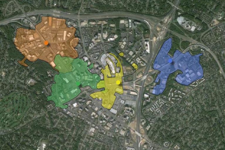

A walkshed is an important depiction of how far a person can get given a certain walkable distance. Typically walkshed maps are either of a 1/4 mile walk distance or a 1/2 mile walk distance. The significant difference bet-ween a walkshed and an aerial map with a radial distance depiction, like those shown in the Tysons Comprehensive Plan, is the walkshed’s inclusion of physical constraints like buildings, lack of sidewalks, or fences that are obstructions to walking.
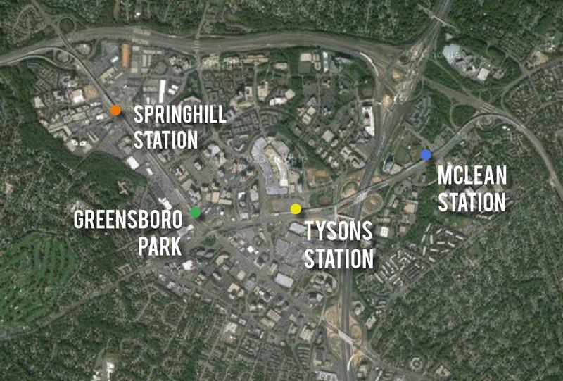
Walkshed maps are useful for determining if large block and auto-centric roadway designs are having impacts on the ability for people to walk. We’ve taken each of the Silver Line metro stations within town and created a walkshed map for a 1/2 mile distance, equivalent to a 10 minute walk. Areas outside of this walkshed are more likely to require vehicles and bus transit to access the metro stations.
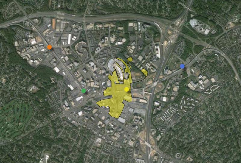
It’s not shocking that the Tysons Metro Station, with its location along Route 123, 495, and disconnected with the massive footprints of the malls, is the least walkable. Some of that can be solved with the elevated plazas and improvements in spot locations of Route 123, but it’s likely that 495 will always be a major barrier to walkability in this neighborhood.
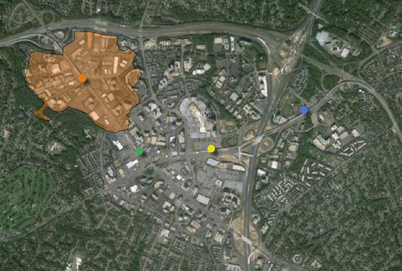
It may be equally shocking how walkable the Springhill Metro Station neighborhood already is, despite the lack of significant redevelopment. Part of this comes from the presence of 1-story and 2-story industrial spaces in the region, but it should serve as hope that new development will not find it very difficult to make the neighborhood welcoming and accessible.
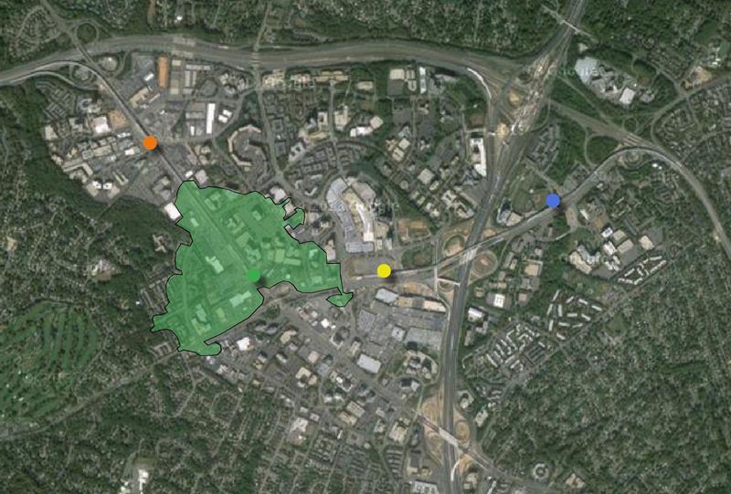
Greensboro Station is also surprisingly walkable along the west side of Route 123, but it becomes obvious that the interchange of Route 7 and 123 creates an unwalkable barrier which will be difficult to solve for planners.

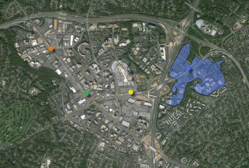
When combined the walksheds for each station show where gaps exist and which stations will have trouble forming a cohesive connection with others. So far it looks like McLean Station will very much continue to be a isolated region of the growing city.