It has been decades since a pedestrian could walk safely from one side of Route 123 to the other at the intersection of Route 7. At that time you would have seen Crossroads Market and Mr. Bless’s farm, when Tysons was a quiet farmland, and well before the Beltway was ever built. Despite the shift from rurality to the 12th largest commercial district in the country, infrastructure centered around people was continuing to get worse.
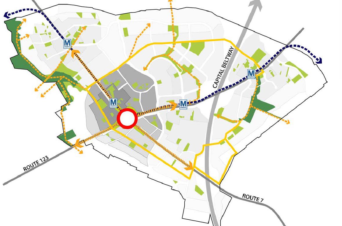
A new study by Fairfax County looks to reverse that trend with ambitious and groundbreaking concepts which would return the human consideration into the heart of Tysons, where the city first grew. During a preliminary charrette (multi-disciplinary design meeting) this summer, planners and transportation designers together created and mocked up their concepts, first by considering the primary goals of all users, second by reviewing the constraints of the built environment, and lastly by collaborating on some workable designs. The results were three substantially variant ideas that the county and all other involved parties will study further in order to flesh out costs, feasibility, and implementation.
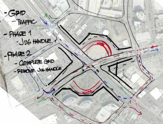
Jug Handle
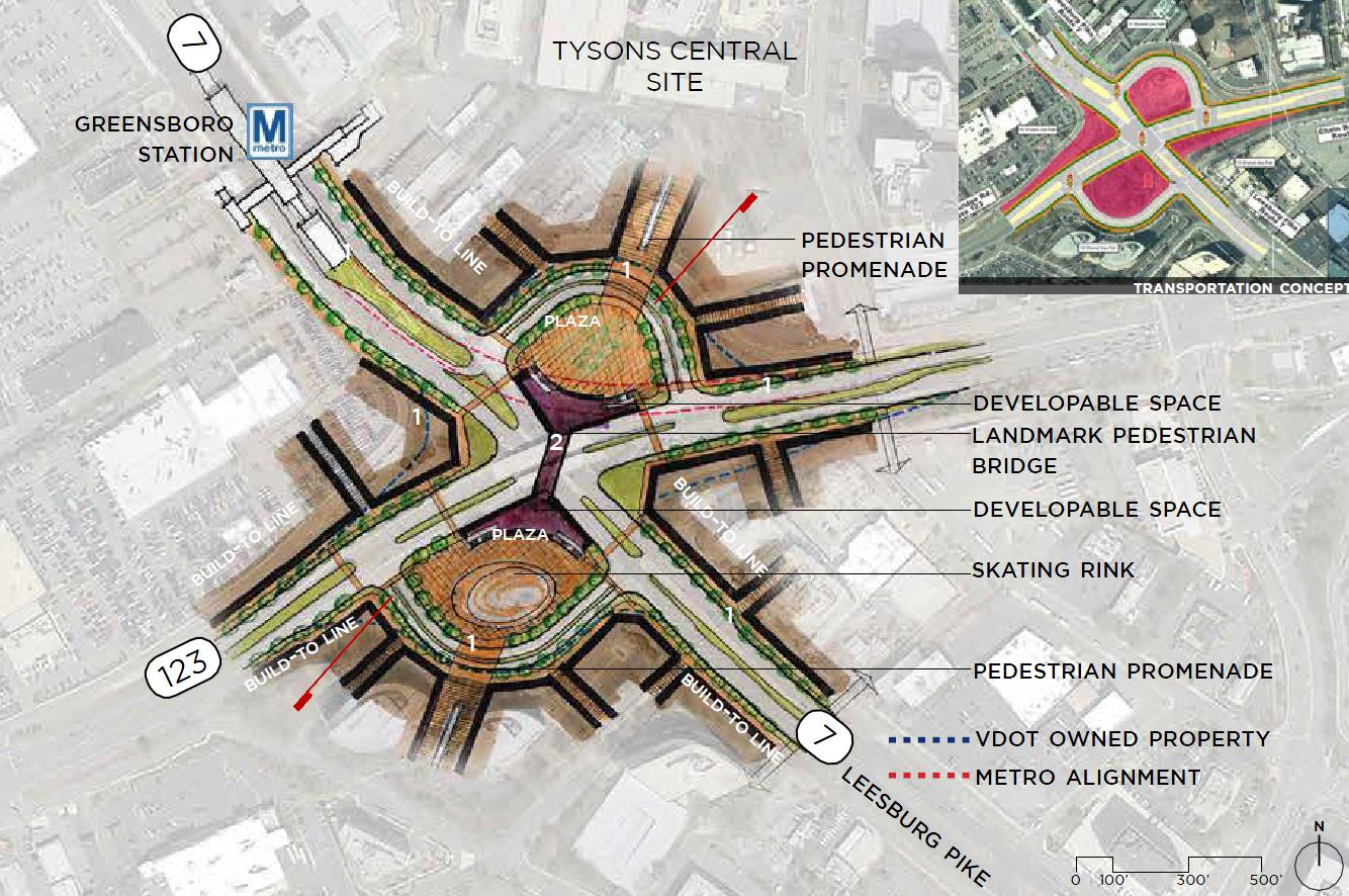
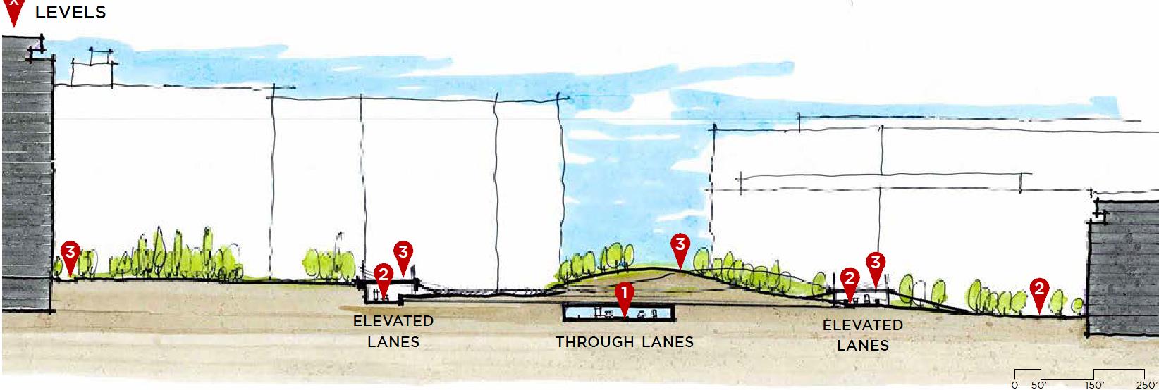
In this concept, through traffic on 123 would be lowered in elevation to make an at grade standard intersection with Route 7. Turn movements from Route 7 to 123 would continue in the same manner, with the tighter parallel onramps, but would be at grade with surroundings. The existing cloverleaf ramps would then change to full intersection turn lanes on Route 123 and 7. The entire zone would then be decked over with a park which would essentially be at the same elevation that Route 123 is today.
Charrette members saw this as an easy to implement, and very cost efficient concept. However, they also saw a lost opportunity in making a true centerpiece to Tysons. Additionally, in terms of priority, this concept prioritizes vehicle throughput more than pedestrian access when compared to the other two concepts. This would be an improvement somewhat, however the likelihood of the at-grade intersection being pedestrian friendly is near non-existent; most folks will not want to walk in the tunnel at this length. Furthermore, the amount of reclaimed space via this concept was deemed as minimal, making a public private cost structure more difficult.
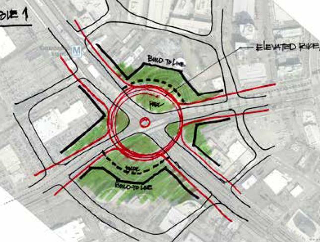
Elevated Closed Plaza
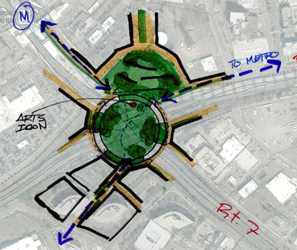
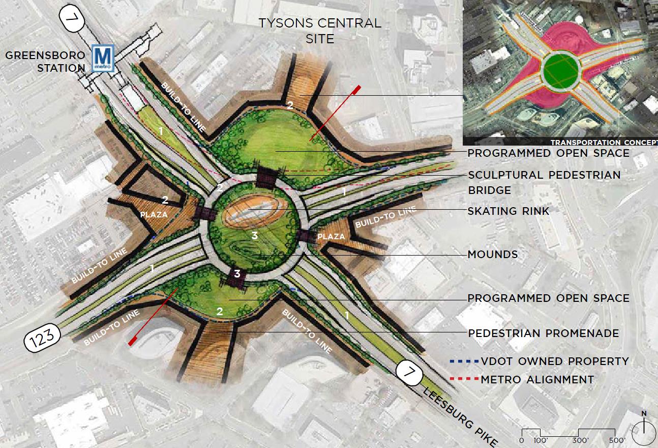 Think a double-stacked Dupont Circle, that’s the idea behind this option for the intersection. Through traffic would largely be unaffected, but the onramps between Route 7 and 123 would instead raise to a roundabout level, condensing the size of the current cloverleaf ramp. This would reclaim several acres of land (as well as a nice central park in the center) that can be activated with new development, public buildings, and good recreational placemaking.
A central circle would certainly provide many opportunities for an iconic fountain, pinnacle, or other piece. This concept would likely be the most urban based, the charrette noted that it best provides for pedestrian movement while also maximizing a private public pay structure. Many of the charrette members wanted to see several park-like amenities in this space (dog parks, recreational facilities, etc.) but I think this is counter intuitive to a round-about concept.
Roundabouts are meant for traffic calming, and rely on their compact size to do so. This has the negative effect of not allowing large open space uses (consider the limited availability for large scale recreational activities at the center of Dupont Circle).
This concept might be suffering from trying to do too much; it may be better to keep the roundabout smaller and limit the open space nature to more of a comfortable and cozy space with a focal object. In this way, the roadway itself will likely run at much slower speeds, making it more pedestrian friendly, and thereby more likely for use. This would also increase the availability of saleable land, making the overall project cheaper, and helping to activate the much needed urban core of the city.
The Cap
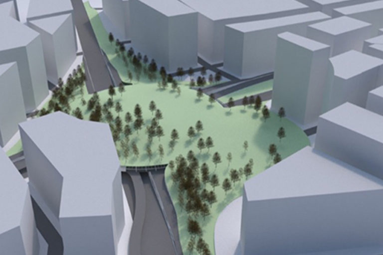
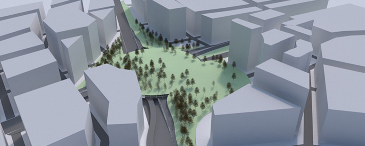
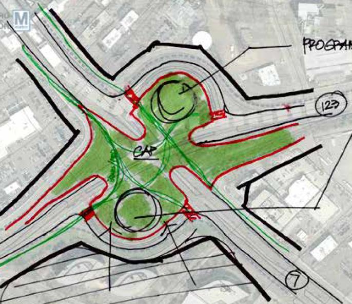
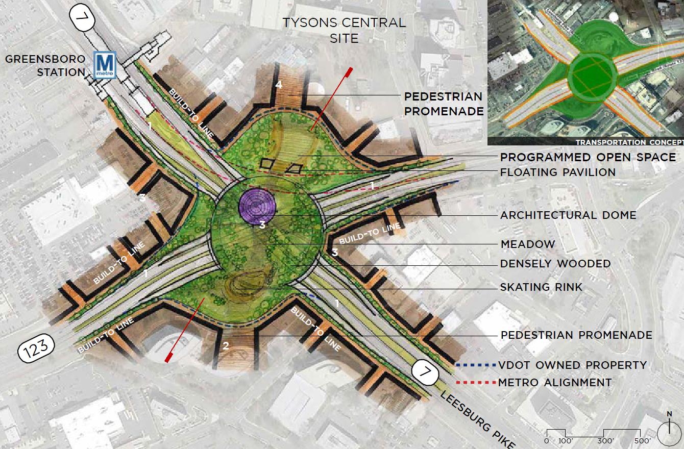 If the last concept was Dupont Circle, the final concept is more like Central Park. The Cap is an idea that seeks to create a human and natural respite in the middle of the urban jungle, with a reclaimed five-to-six acre park that will cover much of both Route 7 and Route 123. A roundabout would still be provided, similar to the elevated closed plaza, but gradual slope would rise to connect West Tysons to Central Tysons in each direction above it all.
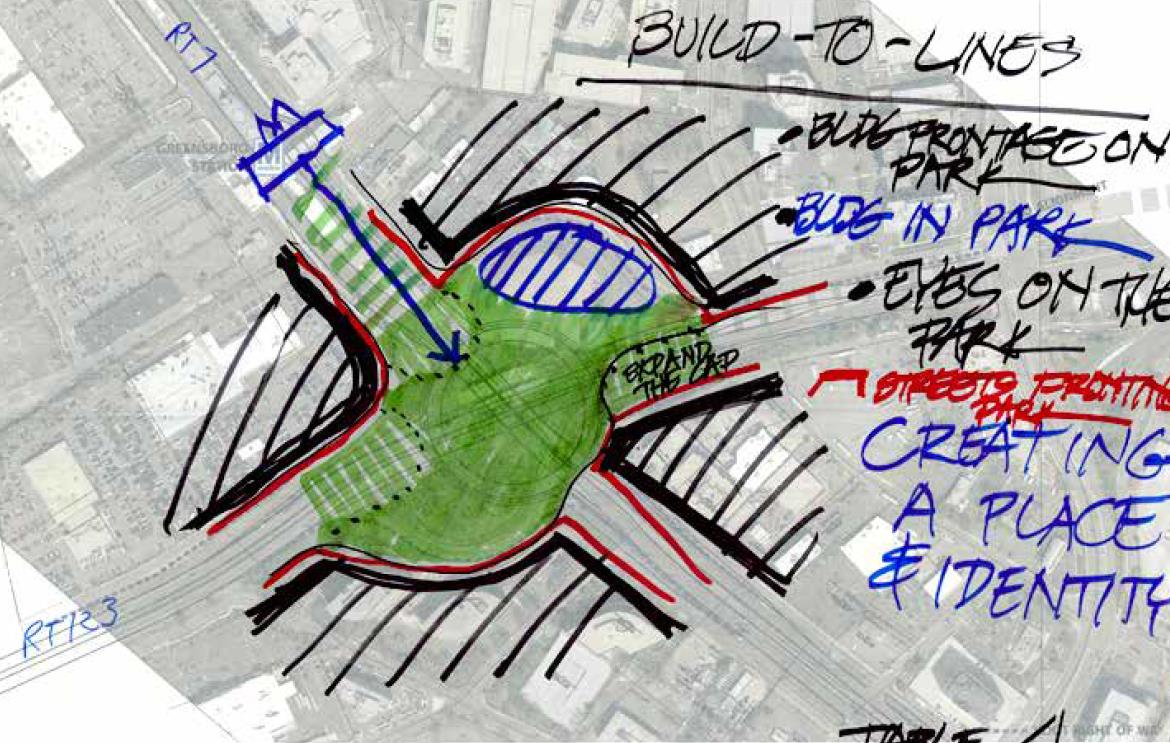
The centerpiece of this would be a public building for the arts, entertainment, or education. There would be some opportunities for development at the edges of the reclaimed airspace, but less so than the Elevated Closed Plaza concept. This Cap may, however, spur some currently low developed parcels to rezone, given the value added of being so close to the central park of Tysons. It also will really help give a better experience to those users coming out of Greensboro Metro, and provide a walking path to the portion of Tysons not directly metro accessible along eastern Route 7.
The space could be the venue for special events like Cirque Du Soleil, city fairs, live performances, etc. The charrette members were most excited about the temporary and transformable nature of The Cap, but noted some concerns that this would be the most expensive in terms of construction costs, and limits availability of private development funding structure (though that could be alleviated with either density allotments at nearby existing parcels or by allowing some development at the edges of the park).

Next Steps
All of the above options are improvements in their own way to the current impassible nature of Route 7 and Route 123. They will, to different degrees, resolve long-standing pedestrian flow problems at the core and heart of the new city. The next steps for the County will be to develop the above three concepts with a higher level of detail. This will include implementation, fine urban design detailing, evaluation criteria, and finalized summaries with the goal of public input. This will also assist in determining funding needs and the opportunity for private involvement. Ultimately the study will result in a preferred alternative and selection.
The groundbreaking charrette to solve the design questions regarding Route 7 and Route 123 included team members from McGuire Woods, American Real Estate Partners, MITRE, Lennar, Rhodeside & Harwell, 2000 Chain Bridge Road LLC, Tysons Partnership, Ashgrove Plantation HOA, BF Saul, Davis Carter Scott, Vika, Wells + Associates, RK&K, Beacon Capital, Holland & Knight, Rotonda COA, Tysons Trace HOA, MCA, Federal Realty, and Macerich. Renderings by RK&K / Rhodeside & Harwell.

