Streetsblog.net addresses some of the insanity in San Francisco surrounding residents who want more housing that is affordable downtown, but want to restrict every project that comes in to limit heights and overall density. Which leads me to wonder, if you don’t allow new units to come up, then why would you expect prices to mysteriously go down. This is a common misconception of many who like limited supply, citing some areas like Detroit, as examples where housing prices can be affordable. What they ignore is the devastating economic blight that has overtaken those areas. So in this context it becomes a decision between supporting new housing or hoping your city’s economy collapses, if you want housing that people can afford.
The application to Tysons, and more importantly to the DC Metropolitan region as whole, are obvious. For over a decade now our region has grown at a pace two times faster than the rate of new housing construction. Inventory levels in Northern Virginia are at all time historic lows, which has created a sudden spike in housing prices. Spikes are bad, spikes are what created the housing bubble. Keeping steady flow of inventory (yes we still need to be building atleast 25,000 dwellings per year to keep up with population growth) with regard to new population is the healthiest way to address our regions housing needs.
NextCity.org takes a break from construction and begins considering nature and the role of waterways on city environmental sustainability. For too long our cities were developed without the basic knowledge of how hydrology works. In fact the earliest concepts of non-point source pollution didn’t arise until the mid-20th century. After the implementation of reforms nationwide to industrial pollution sources we saw a slight bounce in the health of our waterways, yet many areas saw continued inhabitable waterways for fisheries. Today we understand the effects of temperature and increased runoff on waterways that shed from streets and roofs, and there are ways we can re-establish a healthy balance but the best way of all is to use our waterways natural abilities.
Reconnecting the role of our waterfronts between residents and nature helps create activated park lands, which act as amenities to citizens, while also acting as a buffer between constructed zones and unconstructed zones. While technologies like filtration, green roofs, and rainwater harvesting are useful tools in urban settings, nothing compares to the power of natural waterways and their established wetlands in addressing pollution. That is why, when an area has a water body asset, like Scotts Run, it needs to be preserved and protected to work at optimal efficiency and maximum benefit to the community.
A comparison of a Dallas limited access highway and the Champs Elysees shows the folly of relying on traffic queue studies in the appropriation and planning of our roadways. Of course, adding lanes will always mean some increase in throughput, but the reality is that this is a diminishing return. Adding a lane to a 4-lane road has a larger effect than adding one to a 6-lane road, and so on and so on. That is because the additional lane can not address the effects of accidents (lack of alternatives) and actually causes a concentration and funneling of traffic onto the main road which returns it to a congested level.
The healthiest road designs around the world are those that are built with land use in mind, considering the effects of both the lane widening on vehicle through put but also the detriment of it to land use viability and alternative transportation.
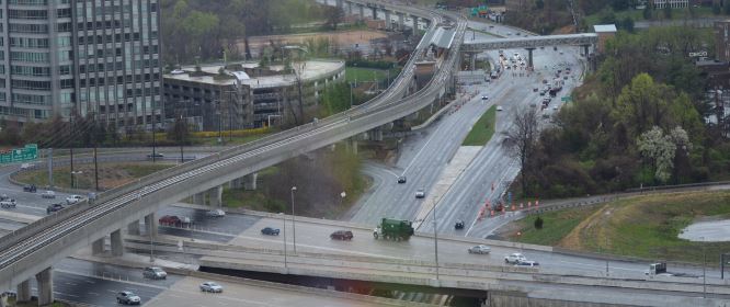
Our standards for roads in Virginia, and Tysons specifically, far too often come from the doctrine from high above in Richmond, which were adopted from the AASHTO handbook. The problem being that these standards were never meant to be used in urban settings where land use and concentrations make the corridors viable for multi-modal transportation options. By implementing highway only designs, the road planners for years have reduced walkability and therefore induced more people getting in cars. This is why the worst traffic cities in the country are actually those with the highest pavement per capita (Atlanta, Houston, Washington, LA) and not those with strong land use and transportation relationships (New York City, Chicago, Seattle, Portland, Denver).
This doesn’t mean you have to have NYC’s subway network (some of the best transportation networks in the world don’t have elaborate subway networks), but it does mean that the way you layout your blocks shouldn’t funnel people to a single point creating bottlenecks. Providing options in a grid format, and doing so in a human scale which allows pedestrians/cyclists/transit to work, is the best way to address transportation needs and are much more cost effective.


