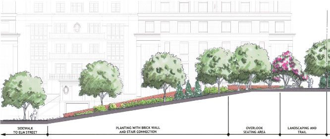
 An unpopular proposal is up for decision at the Planning Commission this month. On Wednesday June, 18th the commission will decide on the fate of JBG’s Elm Street Residential project at 6862 Elm Street in McLean. The project is located in the Central Business Corridor, CBC, of McLean which has a maximum allowable FAR of 1.0. However, the project proposes an FAR of 1.76.
The increase in density has some residents of McLean concerned that urban creep from the planned urban district of Tysons is influencing real estate in the more suburban, although also developed, McLean neighborhood. We wrote about the opposition to the project in December when we noted that the lack of setting strong growth district boundaries would lead to a backlash from County residents, and a dilution of proper transit-oriented design. Allowances for higher densities should be reserved for areas whose transportation can support such changes, or those projects which will help fund the modifications necessary to get higher quality transportation.
Since that time, based on the current staff report, the proposed FAR has actually increased to 1.95 for 240 residential units and 7,010 square feet of retail. The height has also been increased from 6 stories to 7 stories. Despite the increase of density beyond the current allowed 1.0 FAR, staff recommends approval. In the defense of the height of the building, this particular project is adjacent to an existing taller 8 story building. Also, the plan does have some streetscape and neighborhood beautification components.

That, however, doesn’t explain the mitigation for the additional density beyond what was originally planned.
This project, in terms of transportation mitigation (the largest component of any development’s requirements beyond school proffers) proposes new streetscape, monetary contributions to offsite roads, and a bus shelter. Based on the staff report this amounts to $315,000 in proffer contribution for transportation. That’s all well and good until you compare this to what a project in Tysons would be required to pay in support of transportation, via both proffers and on-going special tax districts which over the course of a decade for this level of density would easily triple the cost.
Approval of this plan means that a development is allowed to build, outside of where construction was meant to be near metro stations, for cheaper than within that zone, and in a neighborhood where it makes less sense. That is the definition of urban creep, and undermines that value and work that was put into the Tysons Comprehensive Plan. Given this precedent, why would any developer choose to build in Tysons where millions will be given to the county for transportation, when they could simply go just outside of the boundary and build with a fraction of the mitigation costs?
For all the good things this plan proposes, its lack of proper TOD location, or mitigation in terms of cost, make it a very slippery slope for the County.
